
 https://www.visitbagnoaripoli.it/wp-content/uploads/2022/05/cappellina-baroncelli.jpg
750
1031
wp_14539055
https://www.visitbagnoaripoli.it/wp-content/uploads/2022/05/VISIT-BAGNO-A-RIPOLI.png
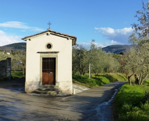
wp_145390552022-05-07 10:43:372022-05-07 10:43:37Itinerary by car, motorcycle or bicycle 2 – The Sacred Streets
https://www.visitbagnoaripoli.it/wp-content/uploads/2022/05/cappellina-baroncelli.jpg
750
1031
wp_14539055
https://www.visitbagnoaripoli.it/wp-content/uploads/2022/05/VISIT-BAGNO-A-RIPOLI.png
wp_145390552022-05-07 10:43:372022-05-07 10:43:37Itinerary by car, motorcycle or bicycle 2 – The Sacred Streets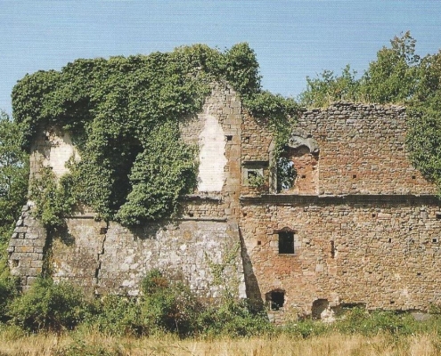 https://www.visitbagnoaripoli.it/wp-content/uploads/2022/05/Palazzaccio-Marcignano.jpg
750
1099
wp_14539055
https://www.visitbagnoaripoli.it/wp-content/uploads/2022/05/VISIT-BAGNO-A-RIPOLI.png
wp_145390552022-05-07 09:53:432022-05-07 09:53:43Itinerary by car, motorcycle or bicycle 3 – The antique Ripulae
https://www.visitbagnoaripoli.it/wp-content/uploads/2022/05/Palazzaccio-Marcignano.jpg
750
1099
wp_14539055
https://www.visitbagnoaripoli.it/wp-content/uploads/2022/05/VISIT-BAGNO-A-RIPOLI.png
wp_145390552022-05-07 09:53:432022-05-07 09:53:43Itinerary by car, motorcycle or bicycle 3 – The antique Ripulae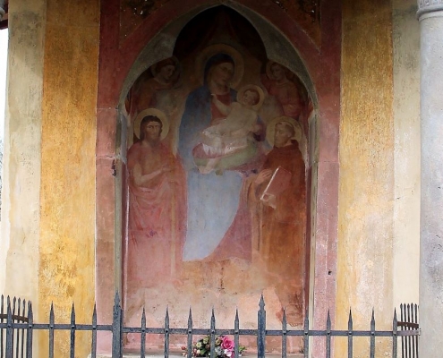 https://www.visitbagnoaripoli.it/wp-content/uploads/2022/06/tabernacolo-di-rimaggino-3-1.jpg
680
1024
wp_14539055
https://www.visitbagnoaripoli.it/wp-content/uploads/2022/05/VISIT-BAGNO-A-RIPOLI.png
wp_145390552022-05-07 09:51:472022-05-07 09:51:47Trekking 1 – From Poggio della Pieve to Valle del Rimaggio
https://www.visitbagnoaripoli.it/wp-content/uploads/2022/06/tabernacolo-di-rimaggino-3-1.jpg
680
1024
wp_14539055
https://www.visitbagnoaripoli.it/wp-content/uploads/2022/05/VISIT-BAGNO-A-RIPOLI.png
wp_145390552022-05-07 09:51:472022-05-07 09:51:47Trekking 1 – From Poggio della Pieve to Valle del Rimaggio https://www.visitbagnoaripoli.it/wp-content/uploads/2022/06/IMG_20220611_170010.jpg
796
1036
wp_14539055
https://www.visitbagnoaripoli.it/wp-content/uploads/2022/05/VISIT-BAGNO-A-RIPOLI.png
wp_145390552022-05-07 09:49:272022-05-07 09:49:27Trekking 2 – Villamagna – Poggio Incontro – Villa Magna
https://www.visitbagnoaripoli.it/wp-content/uploads/2022/06/IMG_20220611_170010.jpg
796
1036
wp_14539055
https://www.visitbagnoaripoli.it/wp-content/uploads/2022/05/VISIT-BAGNO-A-RIPOLI.png
wp_145390552022-05-07 09:49:272022-05-07 09:49:27Trekking 2 – Villamagna – Poggio Incontro – Villa Magna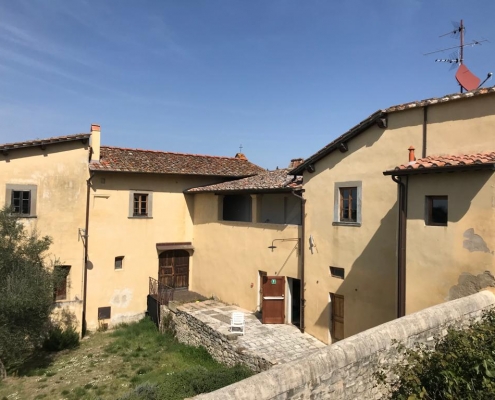 https://www.visitbagnoaripoli.it/wp-content/uploads/2022/06/WhatsApp-Image-2022-06-11-at-17.00.35.jpeg
768
1024
wp_14539055
https://www.visitbagnoaripoli.it/wp-content/uploads/2022/05/VISIT-BAGNO-A-RIPOLI.png
wp_145390552022-05-07 09:45:282022-05-07 09:45:28Trekking 3: The forest and countryside between Monte Pilli and Terzano
https://www.visitbagnoaripoli.it/wp-content/uploads/2022/06/WhatsApp-Image-2022-06-11-at-17.00.35.jpeg
768
1024
wp_14539055
https://www.visitbagnoaripoli.it/wp-content/uploads/2022/05/VISIT-BAGNO-A-RIPOLI.png
wp_145390552022-05-07 09:45:282022-05-07 09:45:28Trekking 3: The forest and countryside between Monte Pilli and Terzano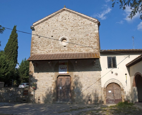 https://www.visitbagnoaripoli.it/wp-content/uploads/2022/06/santa_caterina_delle_ruote.jpg
849
1280
wp_14539055
https://www.visitbagnoaripoli.it/wp-content/uploads/2022/05/VISIT-BAGNO-A-RIPOLI.png
wp_145390552022-05-07 09:35:042022-05-07 09:35:04Trekking 4: From Bagno a Ripoli to Antella
https://www.visitbagnoaripoli.it/wp-content/uploads/2022/06/santa_caterina_delle_ruote.jpg
849
1280
wp_14539055
https://www.visitbagnoaripoli.it/wp-content/uploads/2022/05/VISIT-BAGNO-A-RIPOLI.png
wp_145390552022-05-07 09:35:042022-05-07 09:35:04Trekking 4: From Bagno a Ripoli to Antella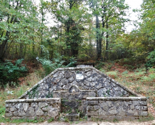 https://www.visitbagnoaripoli.it/wp-content/uploads/2022/06/5-Fonte-Santa.jpg
768
1024
wp_14539055
https://www.visitbagnoaripoli.it/wp-content/uploads/2022/05/VISIT-BAGNO-A-RIPOLI.png
wp_145390552022-05-07 09:30:532022-05-07 09:30:53Trekking 5: From Osteria Nuova to Fonte Santa
https://www.visitbagnoaripoli.it/wp-content/uploads/2022/06/5-Fonte-Santa.jpg
768
1024
wp_14539055
https://www.visitbagnoaripoli.it/wp-content/uploads/2022/05/VISIT-BAGNO-A-RIPOLI.png
wp_145390552022-05-07 09:30:532022-05-07 09:30:53Trekking 5: From Osteria Nuova to Fonte Santa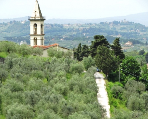 https://www.visitbagnoaripoli.it/wp-content/uploads/2022/06/16-Il-campanile-e-la-campagna-ripolese.jpg
728
1024
wp_14539055
https://www.visitbagnoaripoli.it/wp-content/uploads/2022/05/VISIT-BAGNO-A-RIPOLI.png
wp_145390552022-05-07 09:25:032022-05-07 09:25:03Trekking 6: From Croce a Varliano to Vicchio di Rimaggio
https://www.visitbagnoaripoli.it/wp-content/uploads/2022/06/16-Il-campanile-e-la-campagna-ripolese.jpg
728
1024
wp_14539055
https://www.visitbagnoaripoli.it/wp-content/uploads/2022/05/VISIT-BAGNO-A-RIPOLI.png
wp_145390552022-05-07 09:25:032022-05-07 09:25:03Trekking 6: From Croce a Varliano to Vicchio di Rimaggio