Trekking 5: From Osteria Nuova to Fonte Santa
Type of route: unpaved, practical on foot, mountain bike or horse.
Duration: 3:00/3:30 hours Distance: 8,4 km
Rise in altitude: 565 m; Fall in altitude: 225 m
The starting point is from Osteria Nuova in Piazza F.lli Rosselli (Coord. GPS N 43° 43’48” E 11° 20’44”), where you will cross through the town taking a right on Via del Borro di San Giorgio until passing the highway. After the bridge you should turn left and go down to the Borro di San Giorgio. When you see red and white signs, take another left, which will put you on a shady path that runs along the ravine and leads to “Colonie”. The name recalls the helio therapeutic colonies created along the banks of the stream dating back to the Fascist period. The site, now overgrown and partially occupied by gardens, can still be detected on the right banks of the stream. Just a few steps to the left, going uphill, you can reach the monument dedicated to the partisans Ivo Lazzeri and Giovanni Mutolo.
After crossing the bridge, the road begins to rise gradually through the shady Montisoni woods. The old Casa il Colto will soon appear; the dirt path runs directly behind it then veers off to the left. For a brief time you will pass through the cultivated fields of the house before returning back into the woods. The path will meet up with the unpaved road that connects Montisoni with San Donato in Collina. At the junction turn left towards San Donato. The old road runs through the hillsides amongst forests and chestnut groves, passing Casa Belvedere and Villa Baldasseroni, finally taking you to the intersection where the San Donato cemetery is located.
The path will present numerous splendid panoramic views of the surrounding hills and San Donato. From the cemetery take a right towards the villas and head straight towards II Fico. The road, partly flat, will lead you through young chestnut and oak trees. Once having reached II Fico, continue on for a short distance and then turn right, exiting the junction towards il Faeto. The narrow road climbs towards Poggio Firenze through oaks and chestnut groves and dense forest undergrowth. As you climb the panorama opens up several times to reveal the Upper Valdarno area.
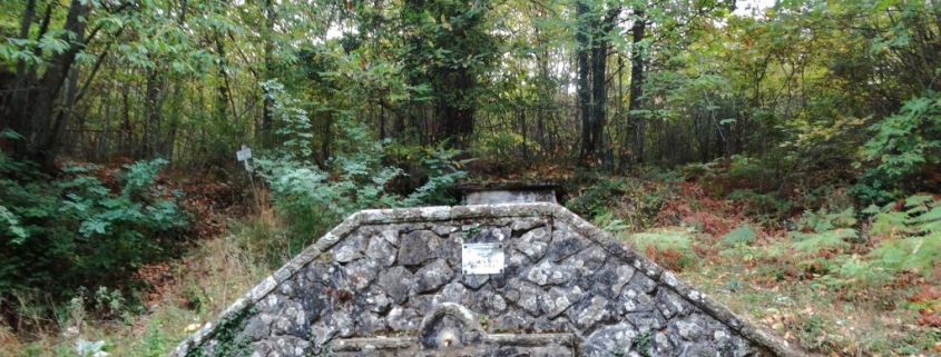
Just before reaching the top of the hill, take the CAI 00 trail (marked by red and white signs). Be careful as many different paths are marked throughout the zone. From here the path will quickly lead downhill towards the lawns of the Fonte Santa. Turning left on the old Via Maremmana trail you will finally reach the Rifugio and Fonte Santa.
This post is also available in: Italian


